In preparation for a lot of work to better understand and release our geospatial (map) data, we had a lovely evening discussing all things maps in Bath.
We are undertaking this work through the Open Data Institute’s Geospatial Stimulus Fund and we are very grateful for their funding and support.
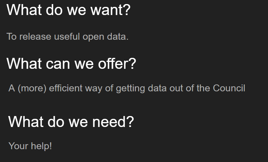
There was an introduction from the Council about their aspirations to produce more open data, that are valuable to local communities and businesses. (view the slides). This will be the part of a longer-term piece of work in collaboration with ourselves.
In short…
We heard from the Council’s GIS (Geographical Information Systems… more maps!) team about their work as well as having a chat about who actually wants maps.
Work has started to populate a list of user stories for open geospatial data. The list has been started and we’d welcome input from anyone who thinks “Yes, I need a map!!”
We heard a few compelling examples of benefits we could see by making our maps accessible; but work is needed to help it to happen. .
The Council has produced analysis on safe routes to schools, but is hampered in releasing the data because of licensing restrictions relating to the underlying data.
Wheelchair users want better information about how to get around in the City, which roads are accessible
We also heard about how the Council’s internal processes and confusion about the current licensing arrangements make it almost impossible to publish data by default.
In addition, Leigh Dodds talked about his recent experiences of trying to use existing published data to find out more about local allotments.
What do we need to know about our data?
We had a conversation about what specifically we need to know about our data to make it useful for people. This went beyond standard metadata and raised issues for categorisation such as:
- Is the data “looked after”? Is it current and well maintained? Or was it produced for a purpose some years ago and no longer valuable?
- What format is it? There was talk about WMS and WFS data, as well as GeoJSON and the ubiquitous .shp files.
- Can the data be opened? Unlike basic tabular data, geospatial data is often associated with or derived from licenced data. In addition, data created by government may often have personal information associated with it, which would need redacting or suppressing.
What next?
Some of the issues that we are going to look at over the next few months include.
- Looking at how the Council produces maps, to see if they can make more use of open formats. When Councils produce this data it is for internal business purposes and re-use is rarely considered.
- Making the best of INSPIRE requirements. This is a requirement to publish certain data to agreed standards. We think we can make this data more reusable.
- Looking at some of the Council’s commercially purchased data, such as aerial photography and whether we have rights to release.
- How to feed data back in to the Council from other open data. Can we make better use of the Environment Agency’s LIDAR data, or Open Street Map?
- What are the best tools for the user? This will depend on the user, but we need to understand the best technology platform to use to publish data and visualise it once it is in the open.
The Council will produce a study in the new year looking at how it can address some of these issues and make a more open environment for its maps.
We then want to get on with the important business of actually getting some data out into the open – and doing things with it.
January 3, 2019 at 9:51 am
Great works guys and Happy New Year!! Hope to see you at an event in Bath in 2019. Best regards,