
In November we announced that we were retiring our current data store. Here’s a quick update on our plans to ensure continued access to all of the local data we’ve published. Including a preview of our new datastore.
The Council has been exploring some ideas about how to more efficiently manage and publish openly licensed mapping data. It has now published a study to show which proposals may be of use to other areas looking to build on… Continue Reading →

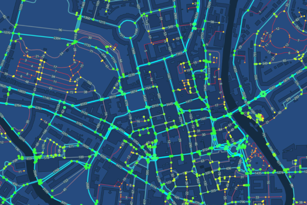
As part of its involvement with the Open Data Institute’s geospatial stimulus programme, Bath and North East Somerset Council has been reviewing how it creates and publishes mapping data. This post looks at the methods of publication and how they… Continue Reading →
Bath:Hacked is rightly here to celebrate all things open. However, sometimes it’s difficult to release data, even when the potential benefits of release are massive. This blog looks at some of the challenges facing councils in releasing open data, using… Continue Reading →
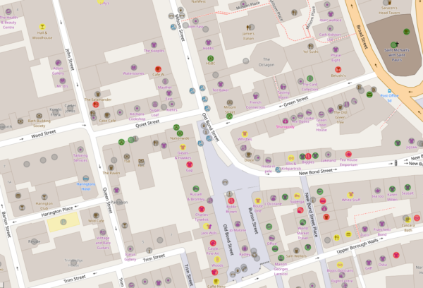
In preparation for a lot of work to better understand and release our geospatial (map) data, we had a lovely evening discussing all things maps in Bath.
Copyright © 2021 Bath: Hacked CiC. All Rights Reserved.
Company No. 09549061